Foreword
To read a building, sometimes you have to gain altitude.
This notebook gathers eight successive maps which, end to end in chronological order, follow 34 boulevard de Clichy from a still-rural edge of Paris to the corner of place Pigalle as we know it today. Each map captures a state: the Farmers-General wall, the annexation of Montmartre, the merging of the three roads, the cabaret façade, the modern plot.
Read in order — 1831, 1834-1862, 1855-1861, 1868, 1872-1880, the “bedsheet” plan 1871-1896, the Poubelle-Alphand atlas 1885, the “height-of-story” plan 1990, the current plan 2020. Three firm milestones structure this journey:
- 1860 — annexation of Montmartre by Paris (law of 16 June 1859, effective 1 January 1860). The 34 enters the newly created 18th arrondissement.
- 1864 — merging of the three former roads (boulevards des Martyrs, Pigalle and Clichy) into a single boulevard de Clichy. No. 34 takes its definitive number.
- 1860-1864 — demolition of the Farmers-General wall (built 1784-1791 by Claude-Nicolas Ledoux) and gradual landscaping of the central median, which would become, above line 2 of the métro (opened 1903), a pedestrian walkway.
1831 — The suburban map, outside the walls
The wall — figured by its dotted line of plantations — separates two worlds. On the Paris side (below), the chemin de ronde; on the Montmartre side (above), buildings already line up against the toll barrier. Two posts are clearly drawn: the Barrière Montmartre on the left and the Barrière des Martyrs on the right, each commanding its passage. The future no. 34 is in the built-up fringe on the Montmartre side, just above the barrière Montmartre.
At this date, the address simply does not exist as a Parisian one: it's a suburban shopfront, the kind of place where wine sells cheaper because the toll has not yet been paid.
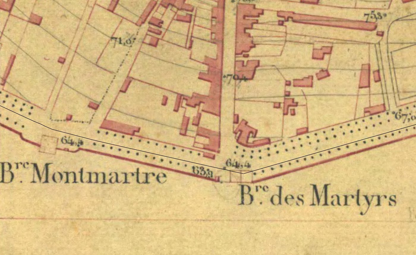
Caption “Bre Montmartre” (left) and “Bre des Martyrs” (right). The dotted line marks the plantings that doubled the wall on the suburban side.
1834-1862 — The topographic map, the fabric closes
A generation later, the urban fabric has thickened on both sides of the wall. The two former chemins de ronde — chemin de ronde des Martyrs on the Paris side, future boulevard extérieur on the Montmartre side — are still distinct, separated by a thin no man's land.
The plot of the future 34 is now built: the main street-front building, dated by the Paris cadastre between 1801 and 1850, is in place when this map is drawn. The 1860 annexation will sweep all this into the new 18th arrondissement.
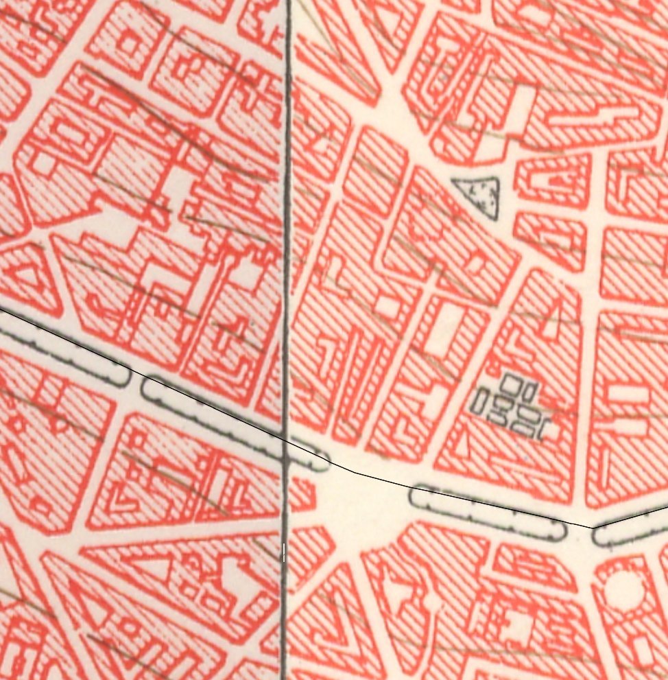
Dense urban fabric on either side of the wall. The thin black line marks the administrative limit — cartographic vestige of the wall that road works will soon absorb.
1855-1861 — The Lefèvre plan, the eve of annexation
One of the last maps to show the situation before 1860. The legend itself keeps the old vocabulary: « Boult des Martyrs » outside the wall, « Chin de ronde des Martyrs » on the Paris side, « Bre des Martyrs » for the toll-gate, « Chemin » heading south.
The toll posts are drawn as small squares flanking the passage. The 34 is in the built band on the Montmartre side, a few metres from the customs post — close enough that, for sixty years, its wine, tobacco and coal had to be declared at every crossing of the wall.
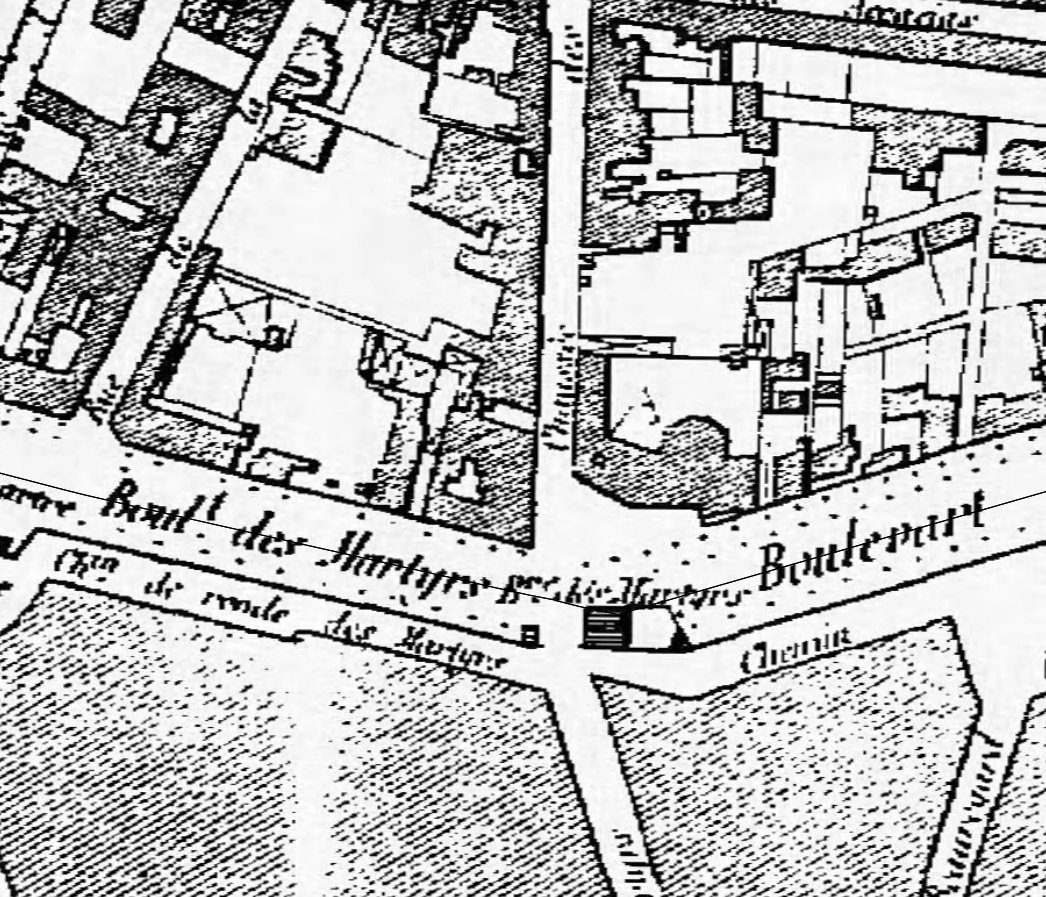
Detail of the Martyrs toll-gate with its two toll pavilions (the small hatched cubes). Today's 34 is in the dense fabric upper left.
1868 — The administrative atlas, four years after the merger
Only four years after the merger of the three former roads in 1864, boulevard de Clichy already appears as a single, fully Parisian artery. Place Pigalle is drawn as a circular square; the boulevard climbs westward. The 18th arrondissement, brand new, integrates the no. 34 within the limits of the city for the first time.
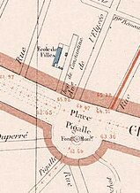
The unified boulevard de Clichy and the newly drawn place Pigalle as a roundabout.
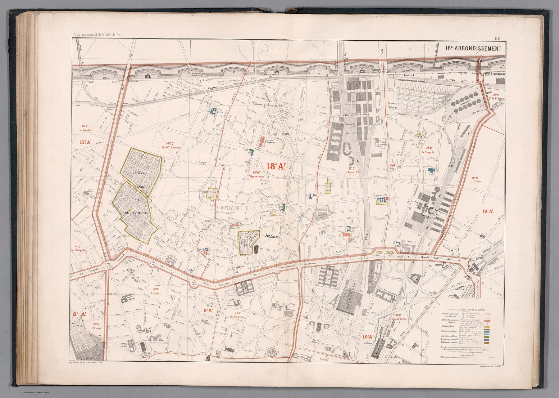
Cimetière du Nord in yellow, La Chapelle railway workshops on the right, Thiers fortifications at the top. The 34 has just taken its definitive number.
1872-1880 — The wall is gone, the promenade settles in
The wall is gone. In its place, an orange-tinted central median now runs the length of the boulevard, planted with trees: this is the future median that will become the pedestrian walkway above line 2 of the métro (opened 1903).
The faint pencilled line follows the former administrative boundary between the 9th (south, odd numbers) and the 18th (north, even numbers) — ghost of the wall that the map has just erased. At this date, no. 34 is a brasserie: the Reichshoffen, where Manet has just painted his last great café-concert canvases.
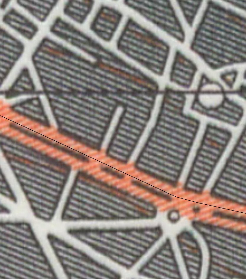
The central orange band materialises the future median. The thin black line that runs along its axis is the cartographic memory of the vanished wall.
1871-1896 — The “bedsheet” plan, the plot in full detail
The most precise document in the series. Surveyed between 1871 and 1896 at 1/500 scale, the bedsheets take their name from their unusual format — huge sheets that reportedly recalled linen stretched on a line. Deposited in 2017 at the Archives de Paris by the DTDF (series PP), they are now consultable online.
Drawn in watercolour, the sheet shows plots in pink, gardens in green, public buildings in pale blue. Just north of boulevard de Clichy, the Asile de Vieillards dit de la Providence — 18th-century almshouse with its ordered gardens — still occupies the block which will be opened in 1908 under the name Villa de Guelma.
The numbered plots along the boulevard (4, 6, 8, 10, 12, 14, 16) follow the old numbering convention; the long, narrow plot of no. 34 — that of the famous double courtyard and the rear-court studios — is already drawn here, exactly as it survives today.
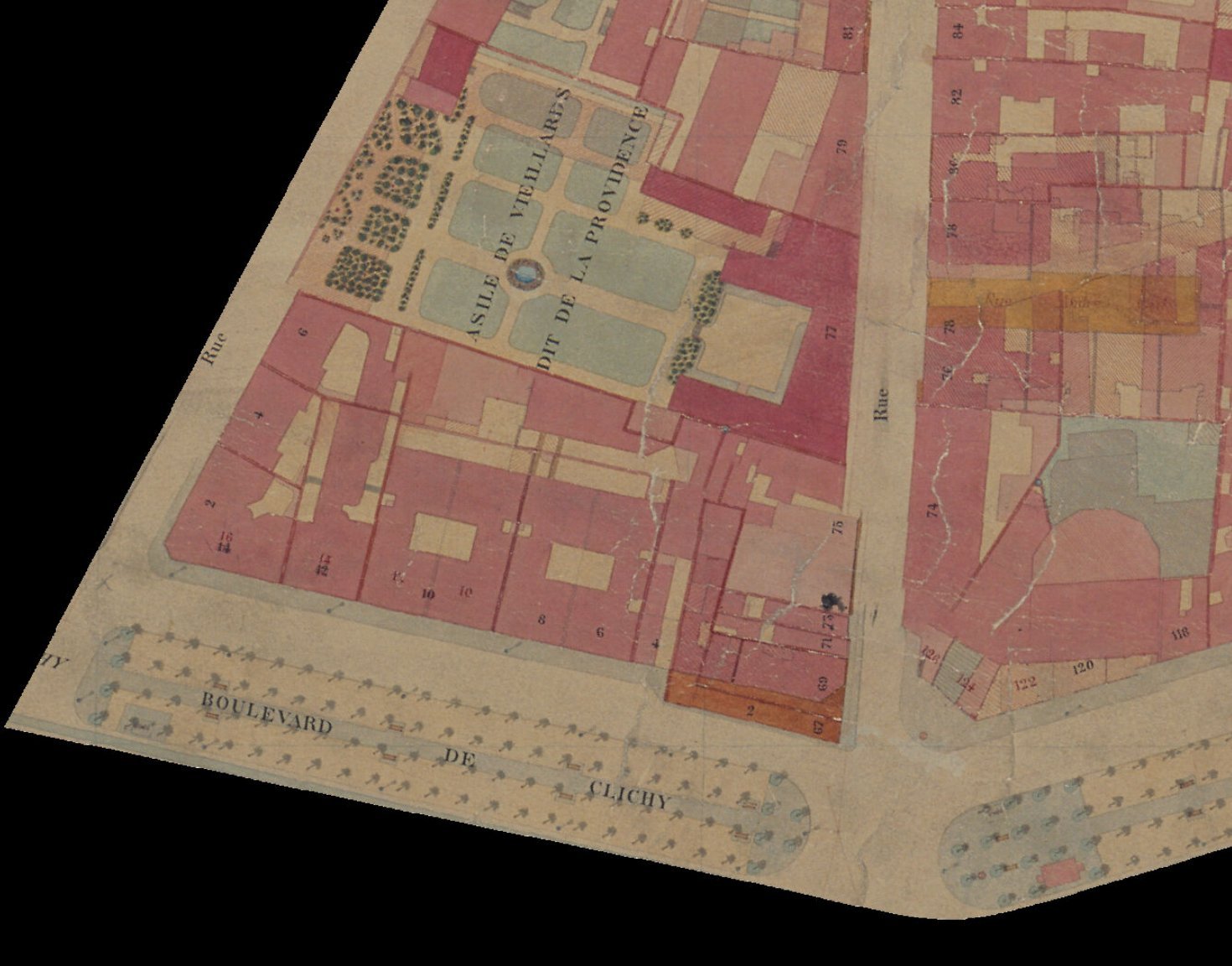
Asile de Vieillards dit de la Providence (the large yellow building in the centre, with its gardens). Below it, plots 4 to 16 of boulevard de Clichy. Plot 4-6 corresponds to today's no. 34: it extends deep northward — the double courtyard-studio.
1885 — The Poubelle-Alphand atlas, the cabaret decade
The cabaret decade announces itself. In 1885 the boulevard is a continuous parade of brasseries, theatres and café-concerts — the milieu Manet has just left, the one the Cabaret de l'Enfer is about to invest.
The Atlas is drawn under the joint authority of Eugène Poubelle (the prefect who, the year before, imposed standardised waste containers on the city — the “poubelle”) and Adolphe Alphand (the engineer of the Haussmannian parks, then at Public Works). The map is administrative, but it is also that of a boulevard at the height of its theatrical reputation.
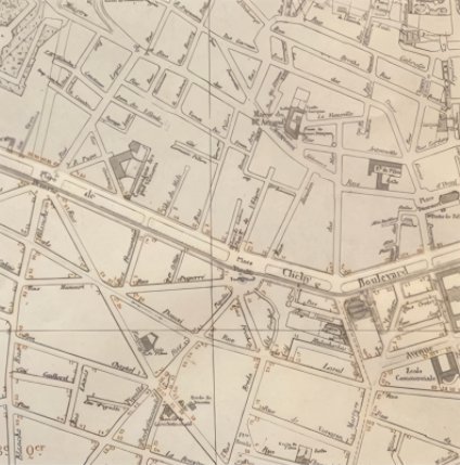
Detail centred on place Pigalle. Boulevard de Clichy is now the structuring axis of the mixed 9th/18th tissue.
1990 — The “height-of-story” plan, a century later
A century later. The administrative grid is the same; the buildings are not. The Asile de la Providence has been replaced by the Villa de Guelma, opened in 1908 — private passage of artists' studios where Picabia, Severini and Léger lived in the 1910s.
The 34 itself has not moved: the same long plot running north from the boulevard, the same sequence street-front building / first courtyard / rear studios / second courtyard. The transformation permit of 1989 (Archives de Paris) had just converted several studios into studio-housing for artists when this plan was drawn — and the heritage cartography records the modification the following year.
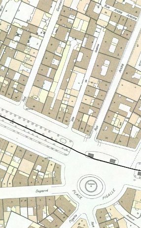
Villa de Guelma has replaced the Asile de la Providence. On the left, rue Germain-Pilon; below, boulevard de Clichy; bottom right, the beginning of place Pigalle.
2020 — The current plan, what survives
The same plot, two centuries later. East of no. 34, the Villa de Guelma; further on, rue André-Antoine; opposite, the promenade Georges-Ulmer (the central median, now landscaped and named) and the entrance to the Pigalle station (line 2, 1903; line 12, 1911).
The shopfront is plain; the courtyard, invisible from the street. But the plot has not moved since the first cadastre — the same 1,867 m² where have succeeded one another a brasserie painted by Manet, a poet of the Internationale, a painter of the Sacré-Cœur, two themed cabarets, a cinema, and four generations of artists in residence.
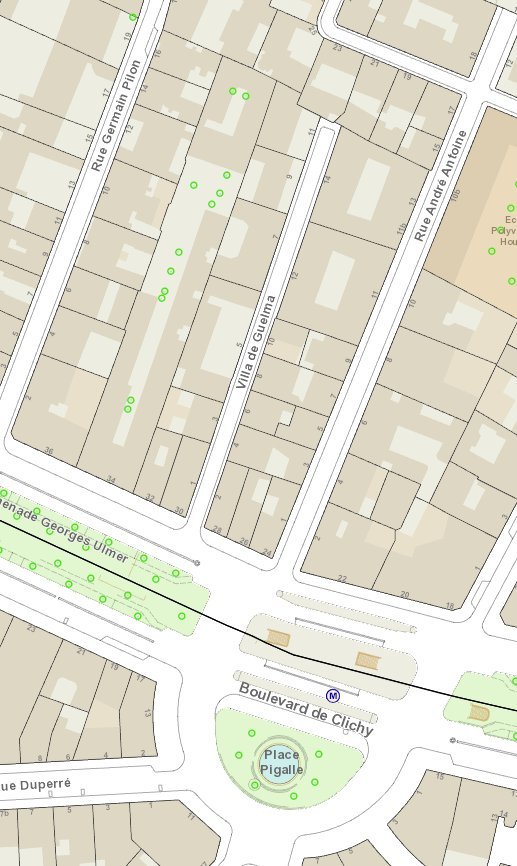
Source: apur.org / IGN. 34 boulevard de Clichy is at the north-west corner of place Pigalle, just west of the Villa de Guelma. The métro station is figured by the “M” at the centre of the median.
Synthesis
The wall is gone; the plot has held.
Read together, the eight maps tell a single story: the slow conversion of a suburban shopfront into one of the most layered Parisian addresses. Everything that makes up the rest of the survey — the Reichshoffen cycle, Pottier's studio, the Cabaret de l'Enfer, Hella Guth's exile, today's studios — happens within the rectangle drawn in these plates.
Three key moments emerge. Before 1860: the 34 is a suburban building, outside the walls, a few metres from a toll post. Between 1860 and 1864: annexation, merger of the roads, demolition of the wall — everything converges to turn a provincial shopfront into a fully Parisian address. After 1864: the plot moves no more. It is on this unchanged parcel foundation that, for one hundred and sixty-two years, the uses that make the building's richness will succeed one another.
Cartographic sources
- Map of the suburbs of Paris outside the Farmers-General wall, 1831 — Bibliothèque nationale de France, Maps and plans department.
- Topographic maps of Paris, 1834-1862 and 1872-1880 — various publishers; details cropped on the Pigalle sector.
- Lefèvre plan, 1855-1861 — one of the last detailed plans to preserve the toll vocabulary before the annexation of 1860.
- Administrative atlas of the 20 arrondissements of the City of Paris, 1868 — Imprimerie Lemercier, plate 14 (18th arrondissement). David Rumsey Map Collection.
- Municipal parcel plan of Paris, known as “bedsheets” — Clignancourt quarter, sheet 120. Archives de Paris, series PP, surveyed 1871-1896, scale 1/500. DTDF deposit 2017.
- Administrative atlas of the City of Paris, 1885 — prefect E. Poubelle, director of public works A. Alphand.
- Parcel plan of Paris, known as “height-of-story”, 1990 — APUR / Mairie de Paris.
- Current cadastral plan, 2020 — apur.org / IGN.
See also
This notebook complements the main page on 34 boulevard de Clichy. For the detailed timeline of uses (brasseries, cabarets, studios, cinema, deportations, studio-housing), see the main survey; for biographies of occupants, see the Artists & historical figures section; for the historical context of the boulevard, see Boulevard de Clichy — full guide.